About District 1
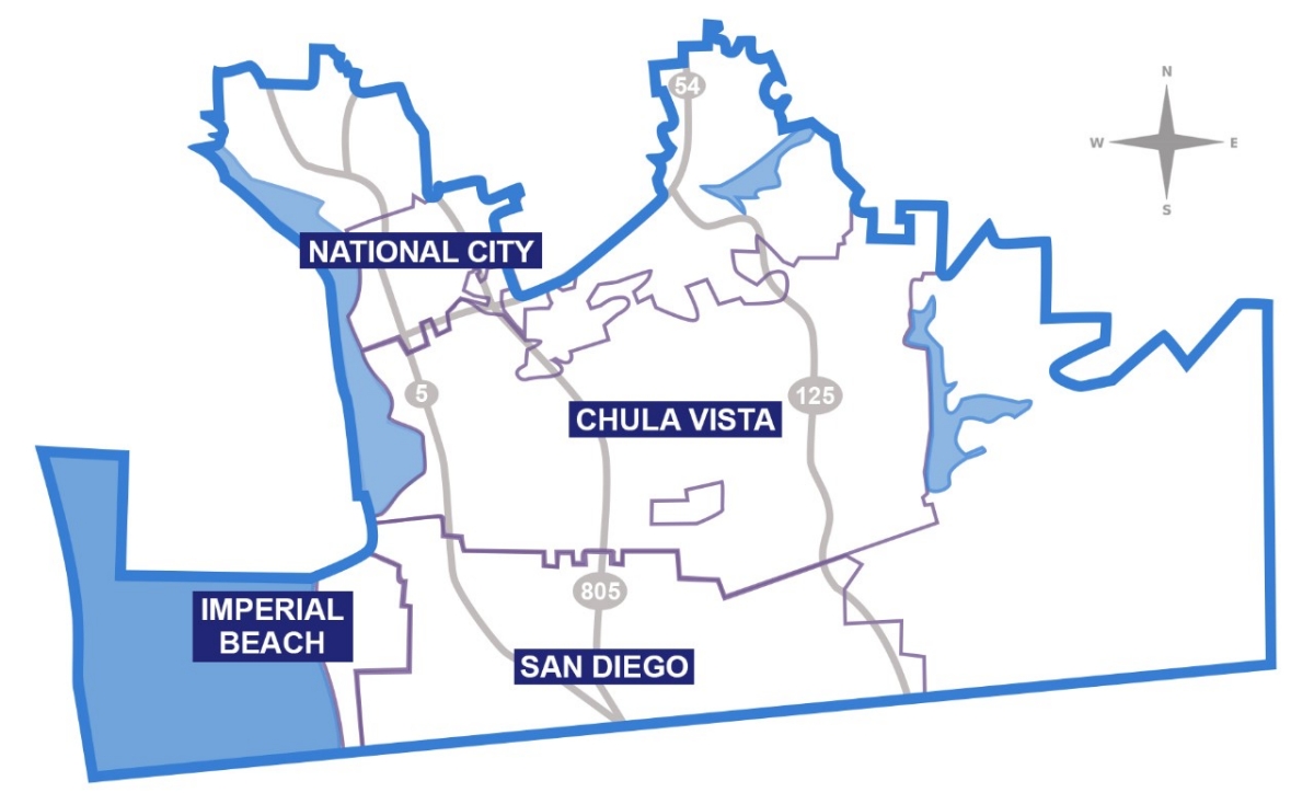
San Diego County’s First Supervisorial District covers approximately 256 square miles and is celebrated for its vibrant cultural and binational connections. The district includes both urban and rural areas, with significant portions of coastline and unincorporated regions.
What are the boundaries of San Diego County’s District 1:
The boundaries of San Diego County’s District 1 include the South Bay region and parts of the U.S.-Mexico border area. The district covers Chula Vista, National City, Imperial Beach, and San Ysidro, along with unincorporated communities like Bonita, Otay Mesa, and the Tijuana River Valley.
The district stretches:
- South to the U.S.-Mexico border
- West to the Pacific Ocean
- North through parts of San Diego including Barrio Logan, Logan Heights, and Sherman Heights
- East to rural
areas like Bonita and parts of Otay Ranch
District 1 is known for its binational connections, serving communities on both sides of the border and addressing cross-border issues such as environmental protection, trade, and public health.
Incorporated Cities
- Chula Vista
- National City
- Imperial Beach
- San Ysidro
- Otay Mesa
- Barrio Logan
- Logan Heights
- East Village
- Golden Hill
- Grant Hill
- Lincoln Park
- Memorial
- Mount Hope
- Mountain View
- Nestor
- Sherman Heights
- South Park
- Southcrest
- Stockton
Unincorporated areas in South County
- Bonita
- Sunnyside
- Lincoln Acres
- East Otay Mesa
- La Presa
- parts of Spring Valley
These ZIP codes are entirely contained within District 1:
- 91902, 91910, 91911, 91913, 91915, 91950, 92136, 92154 and 92173
These ZIP codes are partially contained within District 1:
- 91914, 91917, 91932, 91935, 91977, 91978, 92101, 92102, 92104
What are the County parks and libraries in District 1?
See County library branches to search for a branch near you.
See County Parks' Find a Park page to search for parks near you.
Contact the Office
County Administration Center
1600 Pacific Highway
Rm 335
San Diego, CA, 92101
In-District Office:
South Region Live Well Center at Chula Vista Building
690 Oxford St. 2nd floor.
Chula Vista, CA 91911
Email: District1community@sdcounty.ca.gov
Phone: (619) 531-5511
Website: https://www.supervisorpalomaaguirre.com